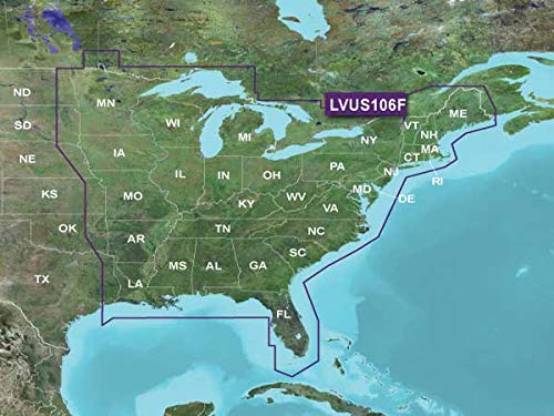
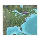
Garmin 010-C1204-00 LAKEVU g3 Ultra East
Garmin 010-C1204-00 LAKEVU g3 Ultra East
Garmin 010-C1204-00 LAKEVU g3 Ultra East
Garmin 010-C1204-00 LAKEVU g3 Ultra East
Provides exceptional coverage, clarity and detail with inland maps that feature integrated Garmin and Navionics data | Auto Guidance technol...
Post Your Offer
Post your offer and receive alerts based on your preferences.
Hodges Marine
[converted from usd currency] Florida https://www.hodgesmarine.com/gar010-c1205-...
Visit Website
Prime Marine
[converted from usd currency] https://www.amazon.com/gp/product/b07r2lmf...
Visit Website
Atlantic Marine Depot
[converted from usd currency] New York https://www.atlanticmarinedepot.com/produc...
Visit Website
SendIt Sailing
[converted from usd currency] South Carolina https://senditsailing.com/products/garmin-...
Visit Website
BassBoatElectronics.com
[converted from usd currency] Tennessee https://www.bassboatelectronics.com/produc...
Visit Website
Walmart
[converted from usd currency] Arkansas https://www.walmart.com/ip/garmin-010-c120...
Visit Website
You may also like
Unable to calculate your location
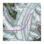
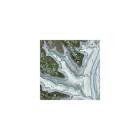
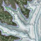
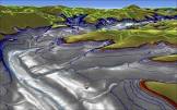
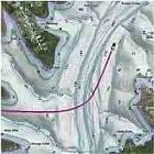
Provides exceptional coverage, clarity and detail with inland maps that feature integrated Garmin and Navionics data | Auto Guidance technology uses your desired depth and overhead clearance to calculate routes and show a suggested path to follow | High-resolution relief shading combines color and shadow to give you an easy-to-interpret, clearer view of bottom structure than contour lines alone | Sonar imagery shows bottom hardness in vivid color so you can easily identify transition areas on 115 U.S. lakes
Experience unparalleled coverage and brilliant detail on the water. LakeV g3 Ultra inland water maps provide exceptional coverage, clarity and detail with integrated Garmin and Navionics data, Auto Guidance technology1 and high-resolution relief shading. Now with superior coverage, extended high-resolution relief shading combines color and shadows to easily find fish-holding structure, artificial reefs, underwater shelves and more. The sonar imagery feature reveals bottom hardness clearly and in vivid color, highlighting both subtle and dramatic transition areas on 115 U.S. lakes.
Regional Links
You may also like

Unable to calculate your location
We use cookies to enhance your browsing experience, By clicking "I Understand", you consent to our use of cookies.